Doing The Iconic Old Telegraph Track OTT

History of the Old Telegraph Track OTT

The iconic Old Telegraph Track (OTT) is now called Telegraph Track.

The OTT was the original path for the Overland Telegraph Line. It used to be the only means of communication for those living on Cape York. And until 1986 the only route to the Tip of Australia. 

When the northern and southern bypass roads opened, maintenance on the OTT stopped. The OTT is now a must do 4 wheel drive track and has northern and southern sections.

When to tackle the Old Telegraph Track OTT

After the wet season it’s wet, boggy in some places and the creeks are high. As it dries, so does the dirt. This means lots of red dust. Which gets into every nook and cranny. And some of the creeks can be dry.

It goes without saying, walk all creeks before crossing and be mindful of crocodiles.

Have fun and take care. Play nice with others and share the spaces with respect to people and the land.

Doing The Iconic
Old Telegraph Track OTT

History of the Old Telegraph Track OTT

The iconic Old Telegraph Track (OTT) is now called Telegraph Track.

The OTT was the original path for the Overland Telegraph Line. It used to be the only means of communication for those living on Cape York. And until 1986 the only route to the Tip of Australia. 

When the northern and southern bypass roads opened, maintenance on the OTT stopped. The OTT is now a must do 4 wheel drive track and has northern and southern sections.

When to tackle the Old Telegraph Track OTT

After the wet season it’s wet, boggy in some places and the creeks are high. As it dries, so does the dirt. This means lots of red dust. Which gets into every nook and cranny. And some of the creeks can be dry.

It goes without saying, walk all creeks before crossing and be mindful of crocodiles.

Have fun and take care. Play nice with others and share the spaces with respect to people and the land.

Palm Creek

The first of the OTT challenges when coming from the south.

The descent into Palm Creek is steep and narrow surrounded by high clay walls.

It has a chicken (side) track for the less adventurous.

Ducie Creek

Ducie and the South and North Alice Creeks are easy to negotiate.

During the dry you could be forgiven for not remembering them.

Dulhunty River

The picturesque Dulhunty River is a simple crossing with an easy drop onto a hard, rocky bottom. 

There is plenty of room for camping. The exit is a sandy easy climb.

Bertie Creek

This is the widest creek on the Southern OTT.

It is also an easy crossing with a rock bottom.

You will need to watch out for some big holes.

Shortly after Bertie is the southern bypass track back to the Bamaga Road.

Cholmondeley Creek

This is a shallow  creek with a sandy bottom.

There is a quick dogleg and you’re on your way to the iconic Gunshot.

Gunshot Creek Crossing

Gunshot Creek is not for the faint hearted.

A near vertical 2.5 metre drop into Gunshot Creek takes nerves of steel and some other quite large body parts to tackle.

With an entry that may have changed over the years it still remains a bucket list challenge for many 4WD visitors to the Cape.

Fortunately, there is a side track. And there is no dishonour for taking it if you are not quite ready to tackle the big ‘gun’. 

Shortly after is the northern bypass back to the Bamaga Road.

Cockatoo Creek

This crossing can look intimidating at first glance.

The best line to take changes each year so it’s a matter of walking it before driving through. 

There is room to camp on the northern bank.

And watch out for Crocodiles around here early in the season.

Sheldon Lagoon

In the dry season if you blink you’ll  miss it.

You need to walk it to check out any deep wheel ruts.

Sailor Creek

Best not to take the bridge as it is not stable.

An easy drop in, a dogleg and you’re out the other side before you know it.

After this crossing you’re nearly half way to the Tip of Australia!!!

Fruit Bat Falls

It’s a must see and do.

It is day access only so no camping allowed.

As it’s in a national park no dogs are allowed. You can leave them in your vehicle.

A beautiful part of the extraordinary Cape with its magical waterfalls and safe swimming holes.

The Queensland Government website has great information about the Falls.

Scrubby Creek

This is one of the few crossings on the OTT you can take an off-road caravan.

There are two options for crossing. The main 4WD track or a short causeway section.

The more challenging track is a steep drop into the creek.

The water crossing is about 40 metres to the red dirt exit.

Eliot & Twin Falls

These are another must see along with The Saucepan.

This section is in Jardine National Park.

That means you will need a permit to camp.

And if you’ve got dogs they are will have to stay in the dog crate or car.

The Queensland Government website has great information about the Falls and the Park.

Canal Creek

This creek has two or three options for entry and exit.

It depends on if you want a sandy or rocky crossing.

The tracks are fairly easy and the choice you make will be based on the condition of the exit.

There is camping on both sides of the creek.

Sam Creek

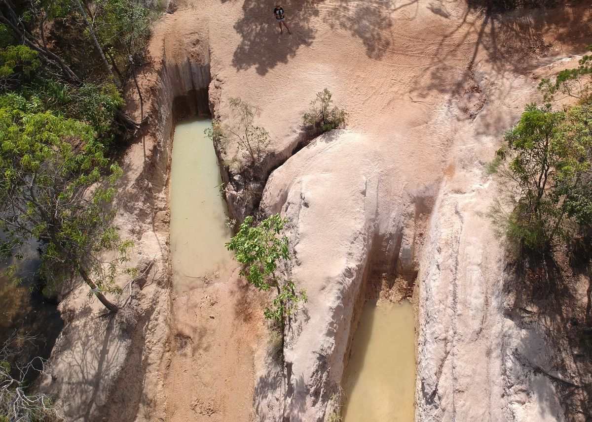
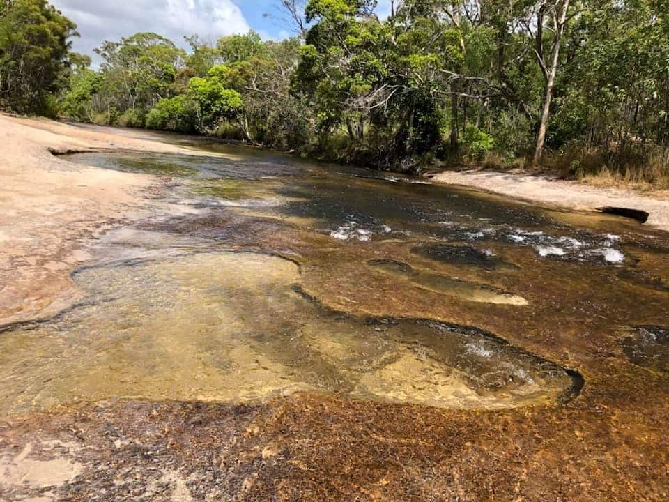
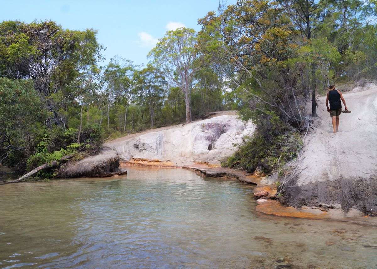
This creek gives you a couple of options for crossing.

The first is on the main track and you will drop into the creek. The bottom is sandy which means it’s best to do a walk through first. The entry can get eroded over the season resulting in deep wheels ruts.

The second option you can take is the rocky bank bypassing most of the creek crossing.

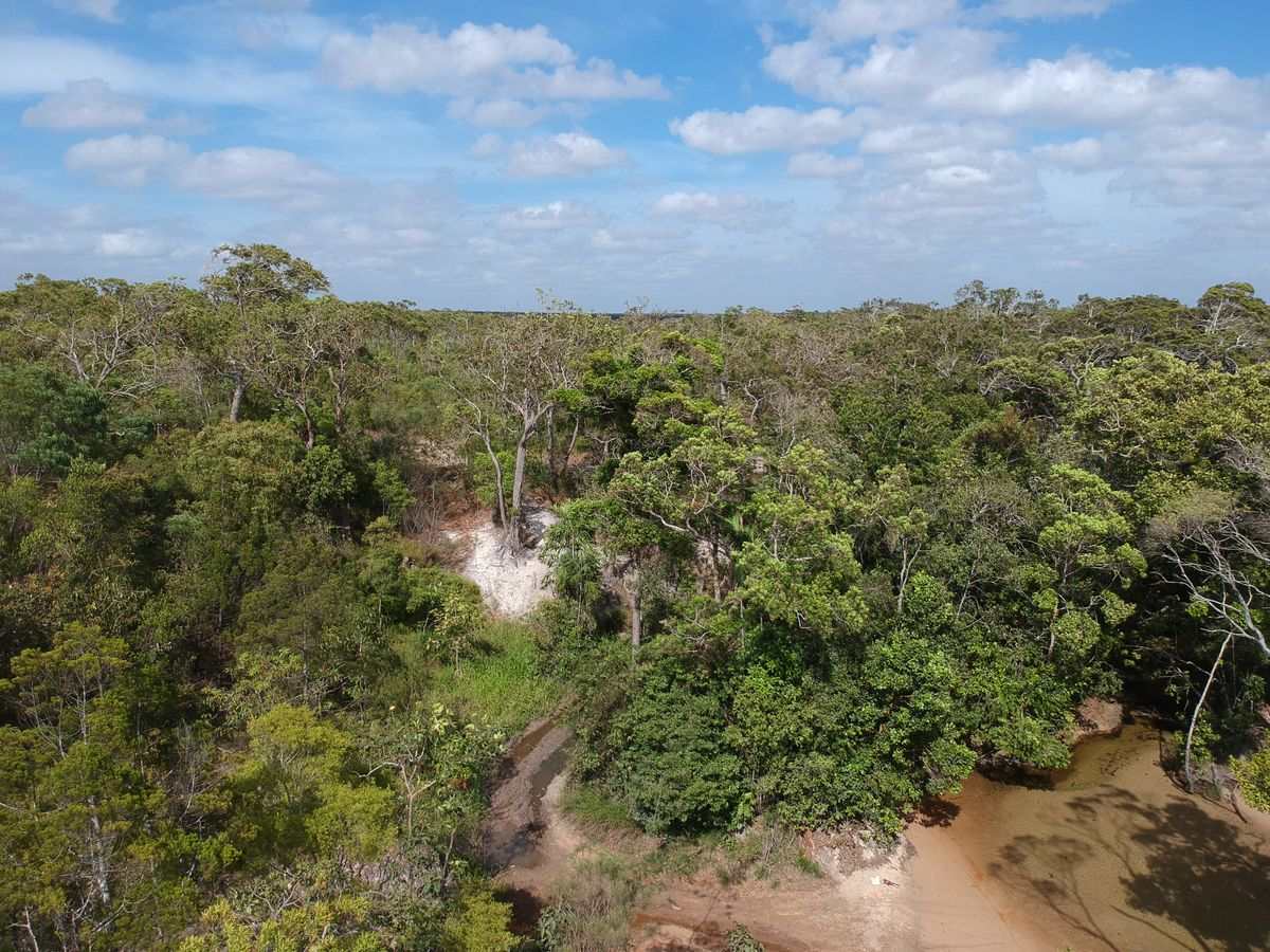
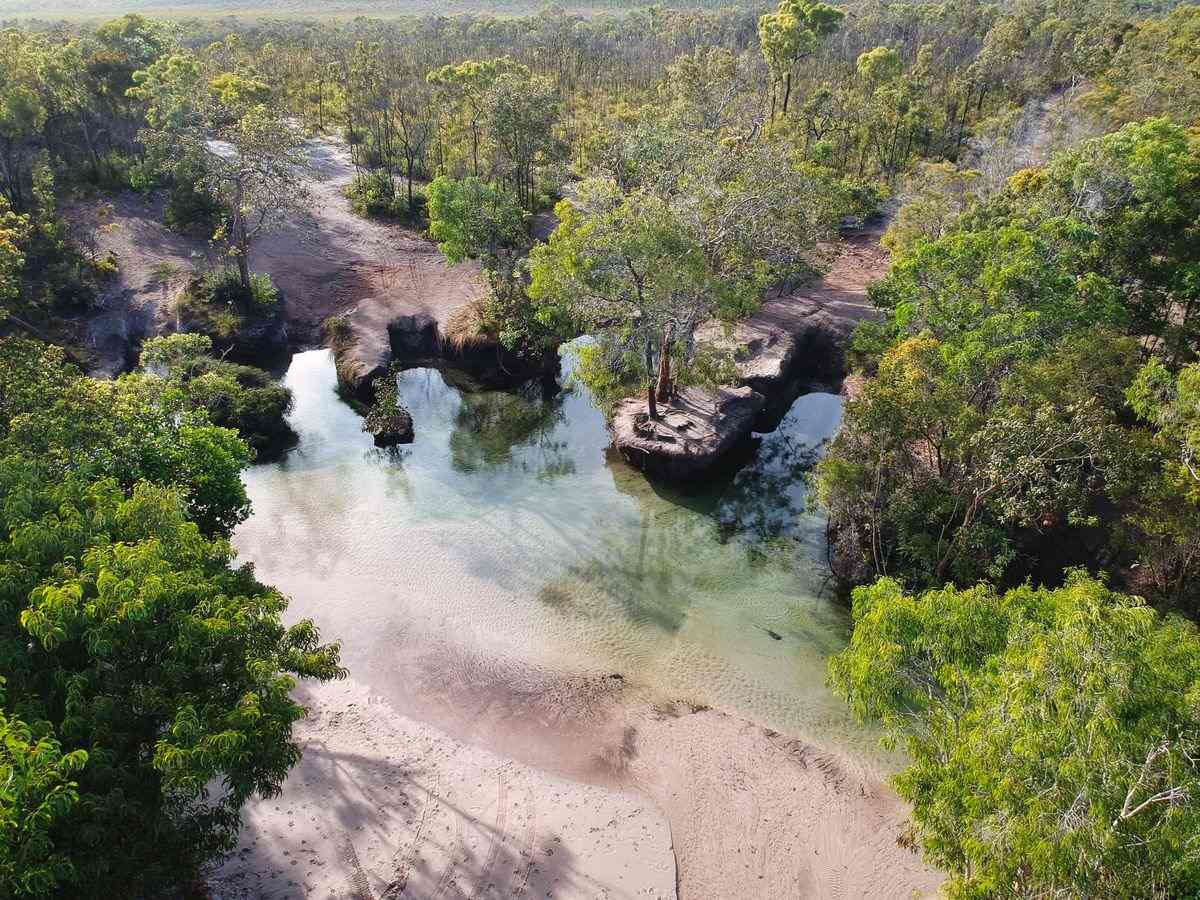
Sam Creek is a top spot to camp with plenty of shade and a delightful waterfall to take a dip.

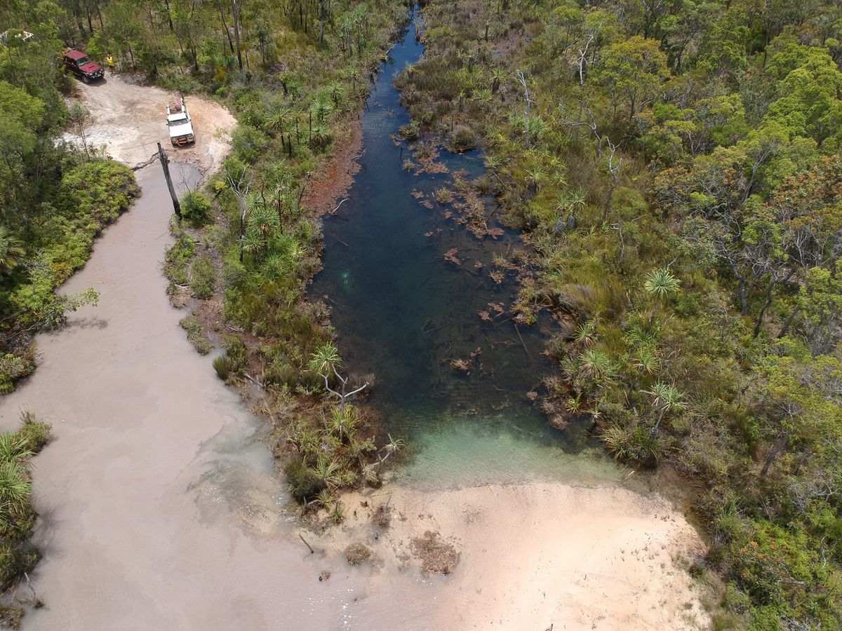
Just north of Sam Creek you can leave the OTT to hook up with Bamaga Road. Or you can keep going to the deeper crossings of Mistake, Cannibal, Logan and Nolans Brook. 

Mistake Creek

It has steepish drop down and an eroded bank.

And then the track takes you through the reasonably shallow waters of Mistake Creek.

At times it may be a bit of a haul coming out on the northern bank.

However, it’s just a matter of picking the correct line and speed.

Mistake Creek Crossing OTT - Explore Cape York

Cannibal Creek

This creek has two entry points.

The first is a steep drop onto a hard base.

And the second will have you dropping onto a softer bottom with a hard right.

The second option can be a bit tight if your towing a camper trailer.

Cypress Creek

This is the most memorable because of the log bridge crossing.

It has had years of ‘repairs’, new logs being put over older ones that have dropped into the creek or disintegrated.

You might find it a bit daunting but if you get yourself lined up it’s easy.

Logans Creek

You will not find Logans Creek on any maps. But it is still a crossing worth chatting about.

You have a choice of 2 entries.

The shorter might seem tempting but it is a lot deeper.

Best to walk both crossings before you drive through.

The exit is relatively easy but, like the rest of the track, the ruts can get deeper as the dry season progresses.

Nolans Brook

The highest mortality rate for vehicles on the OTT is at Nolans Brook.

Make sure you walk Nolans first. It could save you and your vehicle.

Over time the southern entrance has gone from two entry points to six.

Unfortunately this will change the creek drastically if people keep doing this. So please stick to the tracks that are there now.

Before you cross attach your snatch straps. Easier to do it before you start than having to find your recovery points under water.

Be prepared for an audience and lots of advice.